
Accurate roof area quantification
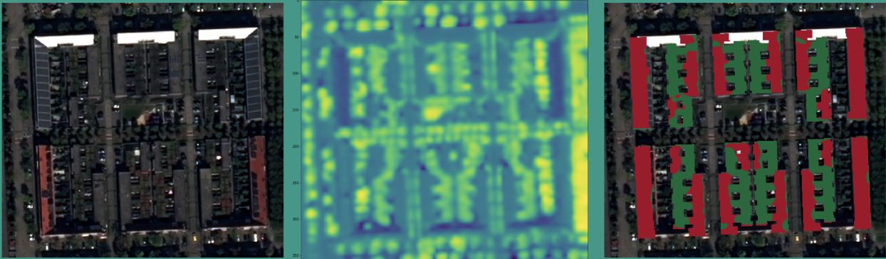
Demo showing buildings with green roofs based on data from OpenStreetMap with NDVI applied.
Lack of comprehensive data
Although the City of Amsterdam has mapped green roof coverage across the city before, they were disappointed in the lack of comprehensive data. For example, in the previous study, if less than 30% of the roof was covered in green, the entire roof area would be logged as a green roof. This meant up that up to two-thirds of the data collected was unreliable and, likely, inaccurate.
To resolve this, and to achieve an accurate estimation of green roof area coverage across the City of Amsterdam, Green City Watch built a proof-of-concept using Very High Resolution (VHR) satellite imagery. VHR imagery enables a pixel resolution of ±30 cm, so we can quantify the exact roof composition, pixel by pixel.
TOOLS & SERVICES:
Very High Resolution (VHR) satellite imagery
KEY OBJECTIVES:
Green roof management